ᓄᓇᕕᒻᒥ ᓄᓇᖕᖑᐊᓕᕆᔩᑦ
NGI ᑐᓂᓯᓲᖅ ᐊᒥᓱᓂᒃ ᐱᒍᑦᔨᐅᑎᓂᒃ ᐃᓱᐊᕆᔭᑎᑦ ᒪᓕᓪᓗᒋᑦ. ᐱᓪᓗᑯᒋᐊᓕᓐᓂᒃ ᐱᒍᑦᔨᓂᐅᑉᐸᑦ ᐅᕝᕙᓗᓘᓐᓃᑦ ᐃᓗᐃᒃᑲᒥᒃ ᐱᓇᓱᐊᕐᓂᒥᒃ ᐊᐅᓚᑦᓯᓂᕐᒧᐊᖓᑉᐸᑦ, ᑕᒫᓃᑉᐳᒍᑦ ᐱᓇᓱᐊᖃᑎᖃᓚᖓᑦᓱᑕ ᐃᓕᑦᓯᓂᒃ ᓄᐃᑦᓯᓂᕐᒧᑦ ᐱᐅᔪᐹᓗᓐᓂᒃ ᐱᓇᓱᐊᕈᑎᕕᓂᕐᓂᒃ. ᖃᐅᔨᒪᔭᐅᔪᒍᑦ ᐊᖏᔪᒥᒃ ᑲᒪᒋᔭᑦᑎᓂᒃ ᑲᒪᒋᔭᖃᓲᖑᒋᐊᑦᑎᓂᒃ ᐊᒻᒪᓗ ᑭᐅᑦᓴᐅᑎᒋᒍᓐᓇᕕᖃᕐᓱᑕ, ᑐᓂᓯᓂᒃᑯᑦ ᐱᓪᓗᑯᒋᐊᓕᓐᓂᒃ ᖃᐅᔨᒪᔭᖃᓪᓚᕆᓐᓂᒥᒃ ᐊᒻᒪᓗ ᐱᐅᓂᕐᐸᐅᔪᓂᒃ ᐱᓇᓱᐊᕐᓯᒪᓂᖃᓂᒥᒃ ᐱᒍᓐᓇᕋᔭᕐᑕᕗᑦ ᐱᓪᓗᑯᒋᐊᓕᒃᑯᑦ ᐱᓇᓱᐊᕐᓂᐅᔪᑦ ᑭᖕᖒᒪᒋᔭᖏᑎᒍᑦ.
ᓄᓇᕕᒻᒥ ᓄᓇᖕᖑᐊᓕᕆᔩᑦ ᒥᑦᓵᓄᑦ
ᓄᓇᕕᒻᒥ ᓄᓇᖕᖑᐊᓕᕆᔩᑦ ᐃᓄᓐᓄᑦ-ᓇᒻᒥᓂᕆᔭᐅᔪᖅ ᖃᐅᔨᒋᐊᕐᕕᐅᓂᕐᒧᑦ ᐱᓇᓱᐊᕐᕕᒃ ᑐᓂᓯᒍᓐᓇᑐᖅ ᓄᑖᓂᒃ ᐊᒻᒪᓗ ᐊᑭᑐᔫᖕᖏᑐᓂᒃ ᓄᓇᖕᖑᐊᓕᕆᓂᕐᒧᑦ ᐋᕐᕿᓱᐃᓂᕐᒥᒃ ᐃᓄᓕᒫᓄᑦ ᐊᒻᒪᓗ ᓇᒻᒥᓂᕆᔭᐅᔪᓂᒃ ᑲᒪᒋᔭᖃᓲᖅ. ᑐᓂᓯᓲᖑᔪᒍᑦ ᖃᒻᒥᓂᑕᐅᓂᕐᐹᓂᒃ ᓄᓇᖕᖑᐊᓕᐅᕈᑎᓂᒃ ᐊᒻᒪᓗ ᐃᓂᒋᔭᐅᔪᓂᒃ ᕿᒥᕐᕈᓂᕐᒥᒃ ᐱᒍᑦᔨᓃᑦ ᑲᑎᕐᓱᐃᓯᒪᓂᒃᑯᑦ ᕿᒥᕐᕈᓯᒪᓂᒃᑯᓗ ᓄᓇᓀᑦ ᐃᓂᖏᓐᓂᒃ ᐊᒻᒪᓗ ᓄᓇᒥ ᕿᒥᕐᕈᓂᕐᒧᑦ ᑲᑎᕐᓱᐃᓂᕐᒥᒃ ᐲᔦᓂᒃᑯᑦ ᑐᓴᕐᑎᓯᐅᑎᑦᓴᓂᒃ ᓄᐃᑕᑎᑦᓯᓗᐊᖕᖑᐊᑐᓂᒃ ᖃᓄᐃᓕᖓᐅᓯᖏᓐᓂᒃ ᐊᒻᒪᓗ ᐊᑦᑐᐊᓂᖃᕐᓂᖏᑦ ᐊᑑᑎᖃᕐᓂᖏᑦ ᐱᓇᓱᐊᕐᑕᓯᓐᓄᑦ. ᐱᓇᓱᒍᑎᑦᓭᑦ ᐊᒻᒪᓗ ᐱᒍᑦᔨᒍᑏᑦ ᐊᑦᔨᒌᖕᖏᑐᑦ ᐱᒋᐊᕐᓱᒋᑦ ᑐᑭᑖᕆᓂᕐᒥᒃ ᓴᐳᑎᔭᐅᓂᖅ, ᐱᓇᓱᐊᕐᑕᐅᔪᒥᒃ ᐊᐅᓚᑦᓯᓂᖅ, ᓄᓇᖕᖑᐊᓕᕆᓂᕐᒥᒃ ᑐᓴᒐᑦᓴᖏᑦᑕ ᐋᕐᕿᓱᕐᓯᒪᐅᑎᖏᑦ (GIS), ᐅᖓᓯᑦᑐᒥᑦ ᖃᐅᔨᓴᕐᓂᖅ, ᖃᖓᑦᑕᔫᒃᑯᑦ ᑲᑎᕐᓱᐊᓴᕐᓂᒃ ᓄᐊᑦᓯᓂᖅ ᐊᒻᒪᓗ ᓇᐅᑦᓯᑐᐃᓂᖅ ᐊᒻᒪᓗ ᓄᐊᑦᓯᓂᖅ ᐱᐅᓯᑐᖃᕐᑎᒍᑦ ᓄᓇᓕᕆᓂᕐᒥᒃ ᖃᐅᔨᒪᔭᐅᔪᑐᙯᑦ (TEK).
ᐱᐅᓯᑐᖃᕐᑎᒍᑦ ᖃᐅᔨᒪᔭᖃᕐᓂᖅ ᐊᒻᒪᓗ ᐊᑐᕐᓂᒥᒃ ᖃᐅᔨᓴᕐᓂᖅ
ᐱᐅᓯᑐᖃᕐᑎᒍᑦ ᖃᐅᔨᒪᔭᖃᕐᓂᖅ ᐊᒻᒪᓗ ᐊᑐᕐᓂᒥᒃ ᖃᐅᔨᓴᕐᓂᖅ ᐱᓪᓚᕆᐅᕗᖅ ᐱᕕᑦᓴᖃᕐᑎᓯᓚᖓᓂᕐᒥᒃ ᓄᓇᖃᕐᖄᓯᒪᔪᑦ ᓄᓇᓕᖏᑦ ᐱᒍᓐᓇᕕᖃᑦᓯᐊᖁᑦᓱᒋᑦ ᓄᐃᑕᑦᓯᐊᑐᒥᒃ ᑫᓪᓗᐊᕆᒍᓐᓇᖁᑦᓱᒋᑦ ᐱᔪᓐᓇᐅᑎᒥᓂᒃ ᐊᒻᒪᓗ ᐱᒍᒪᔭᕐᒥᓂᒃ ᐊᖏᖃᑎᒌᒐᓱᐊᕐᓂᓂᒃ ᐱᓇᓱᕝᕕᒪᕆᓐᓂᒃ ᑲᕙᒪᓂᓗ ᐅᕝᕙᓗᓘᓐᓃᑦ ᐱᐅᓯᕐᓲᑎᑐᐃᓐᓇᑎᒍᑦ ᐊᒻᒪᓗ ᐊᕙᑎᓕᕆᓂᕐᒥᒃ ᖃᐅᔨᓴᕐᓂᓄᑦ ᐱᓇᓱᐊᕐᑕᐅᓂᖏᒍᑦ.
NGI-ᑯᑦ ᐱᓇᓱᖃᑎᖃᓲᑦ ᐃᓄᑐᖃᕐᓂᒃ ᐊᒻᒪᓗ ᖃᐅᔨᒪᔭᕐᒥᓂᒃ ᑎᒍᒥᐊᕐᑐᓂᒃ ᓇᓗᓀᔦᖁᔨᑦᓱᑎᑦ ᓄᓇᖕᖑᐊᓂᒃ ᖃᓄᖅ ᓄᓇᓖᑦ ᐊᑐᓲᖑᒻᒪᖔᑕ ᓄᓇᒥ ᐃᒪᕐᒥᓗ ᒪᙯᓐᓂᒧᑦ, ᒥᑭᒋᐊᕐᓂᐊᓂᕐᒧᑦ, ᐃᖃᓪᓕᐊᓂᕐᒧᑦ, ᐱᕈᕐᑐᓂ ᓄᐊᑦᓯᓂᖅ, ᐊᐅᓪᓛᓯᒪᓂᖅ, ᐊᒻᒪᓗ ᐊᒥᓱᑦ ᐊᓯᖏᑦ ᐱᒻᒪᕆᑦ ᐱᓇᓱᐊᕐᑎᓯᓂᐅᔪᑦ. ᐋᕐᕿᒋᐊᕐᓂᖃᕈᓐᓇᑐᒍᑦ ᖃᓄᐃᓘᕈᓯᑦᑎᓂᒃ ᓄᓇᓖᑦ ᑭᖕᖒᒪᒋᔭᖏᑦ ᐱᑦᔪᑎᒋᑦᓱᒋᑦ, ᑐᓂᓯᒍᒪᓂᕐᒧᑦ ᐱᓇᓱᐊᕐᓯᒪᓂᒥᒃ ᓈᒻᒪᓈᑦᓯᐊᑐᒥᒃ ᐊᒻᒪᓗ ᐊᑐᕐᓂᖃᑦᓯᐊᑐᒥᒃ, ᐊᒻᒪᓗ ᓲᖑᓯᒋᐊᕆᔪᒥᒃ ᓄᓇᓕᐅᑉ ᓂᐱᖓᓂᒃ ᓄᓇᓕᐅᑉ ᐃᓗᐊᓂ ᓯᓚᑖᖓᓂᓪᓗ. NGI-ᑯᑦ ᖃᐅᔨᒪᖃᓪᓚᕆᓐᓂᖏᑦ ᓄᓇᖕᖑᐊᓕᕆᓂᕐᒥᒃ ᐊᒻᒪᓗ GIS-ᒥᑦ ᐊᒻᒪᓗ ᓄᓇᒥ ᐱᒻᒪᕆᐅᕗᑦ ᑕᒪᑦᓱᒧᖓ ᐱᓇᓱᐊᕐᓂᒧᑦ.
NGI ᓄᓇᕕᒻᒥ ᓄᓇᖕᖑᐊᓕᕆᔩᑦ ᐱᒍᑦᔨᕕᖓ
ᖄᖏᕐᓂᑯᓕᐅᕋᓱᐊᕐᓂᒥᒃ ᐊᖏᓕᒋᐊᕆᓂᕐᒧᑦ ᖃᓄᕐᑑᕈᑎᐅᑎᓪᓗᒍ ᓴᐳᑎᔭᐅᑎᓗᒋᑦ ᒫᓐᓇᐅᔪᖅ ᓂᐅᕕᐊᑦᓴᑎᓐᓄᑦ ᐊᒻᒪᓗ ᐱᒍᑦᔨᐅᑎᑎᓐᓄᑦ ᐱᒍᑦᔨᒍᓐᓇᓂᕗᑦ, ᓄᓇᕕᒻᒥ ᓄᓇᖕᖑᐊᓕᕆᔩᑦ ᑐᓂᓯᑦᓴᑐᐃᓐᓇᕈᒪᔪᑦ ᓄᐃᑕᑦᓯᐊᒪᕆᑦᑐᓂᒃ ᑲᑎᕐᓱᐊᓂᒃ ᓄᐊᓯᒪᔭᕐᒥᓂᒃ ᐊᒻᒪᓗ ᓇᐅᑦᓯᑐᐃᓂᕐᒥᒃ ᐱᒍᑦᔨᓃᑦ ᐊᑐᕐᓂᑯᑦ ᖁᓕᒥᒎᕌᐱᓐᓂᒃ. ᑕᒪᑦᓱᒪᐅᑉ ᐱᒍᑦᔨᓂᐅᑉ ᐱᒍᑦᔭᐅᒍᑎᖏᑦ ᐱᕕᑦᓴᖃᕐᑎᓯᓚᖓᔪᑦ ᐱᕕᑦᓴᖃᕐᑎᓯᒋᐊᓪᓛᓂᕐᒥᒃ ᑐᑦᓯᕋᐅᑎᐅᓕᕈᓂ ᐊᒻᒪᓗ ᓄᐃᑎᒋᐊᓪᓛᕈᓐᓇᑐᓂᒃ ᐊᑦᔨᖑᐊᓂᒃ ᐱᖃᑦᑕᕈᓐᓇᓂᒃᑯᑦ ᐱᒍᑦᔨᔭᑦᑎᓄᑦ ᐊᑦᔨᒌᖕᖏᑐᓂᒃ ᐱᓇᓱᐊᕐᕕᒪᕆᐅᔪᓂᒃ.
ᐃᓱᒪᑦᓯᐊᓂᕐᓴᑯᑦ ᐃᓪᓗᓕᐅᕐᓂᖅ ᐱᒋᐊᕈᑎᖃᓲᖅ ᐃᓗᓕᖃᑦᓯᐊᑐᓂᒃ, ᑲᑎᕐᓱᐊᖃᑦᓯᐊᑐᓂᒃ ᓴᓇᒍᑎᐅᒍᓐᓇᑐᓂᒃ ᐆᑦᑐᕋᐅᑎᑦᓯᐊᖑᒍᓐᓇᑐᓂᒃ. NGI-ᑯᑦ ᖁᓕᒥᒎᕌᐲᑦ ᐱᒍᑦᔨᕕᖏᑦ, ᐱᕕᑦᓴᖃᕈᓐᓇᑐᑎᑦ ᓓᓴᓐᓯᓕᓐᓂᒃ ᖁᓕᒥᒎᕌᐱᓐᓂᒃ ᐊᐅᓚᑦᓯᒍᓐᓇᑐᓂᒃ ᐱᓇᓱᐊᓯᑐᐃᓐᓇᕆᐊᓕᓐᓂᒃ ᐊᒻᒪᓗ ᑐᓂᓯᒍᓐᓇᓱᑎᑦ ᐱᒐᓱᐊᕐᑕᑎᓐᓂᒃ ᖃᐅᔨᒍᒪᔭᕕᓂᑎᓐᓂᒃ ᑐᑭᑖᕆᒍᑎᒋᓂᐊᕐᓱᒋᑦ ᐱᕕᑦᓴᑭᑦᑑᒐᓗᐊᕐᐸᑦ ᐆᑦᑑᑎᒋᓗᒋᑦ 24 ᑫᕙᓪᓚᒍᓰᑦ. ᐱᖁᑎᓖᑦ ᓄᑖᑦᓯᐊᓂᒃ, ᖃᐅᔨᓴᕈᑎᑦᓯᐊᒪᕆᓐᓂᒃ ᐊᒻᒪᓗ ᓄᑖᖑᔭᐅᓂᕐᐹᓂᒃ ᐊᑦᔨᓕᐅᕈᑎᓄᑦ ᖃᐅᔨᓴᐅᑎᓂᒃ ᐊᒻᒪᓗ ᐊᑦᔨᓕᐅᕆᓂᕐᓄᑦ ᐃᑯᒪᐅᑎᒨᕐᑐᔭᓂᒃ, NGI-ᑯᑦ ᖁᓕᒥᒎᕌᐱᖏᑦ ᓄᐊᑦᓯᒍᓐᓇᑐᑦ ᒫᓐᓇᓂᑖᐱᓐᓂᒃ ᑲᑎᕐᓱᐊᓂᒃ ᐊᐅᓚᑦᔦᕙᓪᓕᐊᓂᕐᒧᑦ ᐃᒻᒥᓂᒃ ᑲᔪᓯᔪᒥᒃ ᖃᐅᔨᓴᕈᑎᓂᒃ ᐊᑦᔨᒌᖕᖏᑐᓂᒃ ᐊᑐᕐᑕᐅᒍᓐᓇᓱᓂ ᐊᑯᓃᕐᑌᓕᓂᕐᒧᑦ ᐊᒻᒪᓗ ᐱᕕᓕᒫᖓᒍᑦ ᖄᖏᕐᓂᑯᓕᐅᕋᓱᐊᕐᓂᒧᑦ.
ᐃᓱᒪᑕᐅᓂᒃᑯᑦ ᑲᑎᕐᓱᐊᕕᓃᑦ ᓄᐃᑕᓂᕕᓂᖏᑦ ᓲᖑᔪᒻᒪᕆᓐᓄᑦ ᖃᐅᔨᓴᐅᑎᓄᑦ ᐅᑯᓂᖓ ᐃᓚᖃᕐᑐᑦ: Video, LIDAR, Visual, Thermal IR, Hyperspectral
Whether your infrastructure is a wind turbine, a powerline, a pipeline or a flare stack, visual inspections using camera stills and/or video allows you to identify any damage to the infrastructure that could cause further or more costly damage in the long-term. Using drones for aerial inspections in comparison to traditional methods reduces risk to human life, offers quicker inspection turnarounds, and less down time.
Create a seamless high resolution map of an area. Using both nadir and oblique images, we can develop both Digital Terrain and Digital Surface models that users can view and manipulate from multiple perspectives in a single computer-generated model. If you need super accurate ground control, we can collect Ground Control Points (GCPs) using our survey grade Trimble GPS and post-process your data to geometrically correct the resultant images.
The use of drones have proven to be a useful and viable solution for wildlife studies in various environments. They are a safe way for scientists to observe their subjects and are of course less costly, more efficient and more precise than traditional approaches. Drones have been used in a variety of studies including population studies (counting the number of seals at a haul-out location) and nest surveys where individual eggs can be counted using the resultant images.
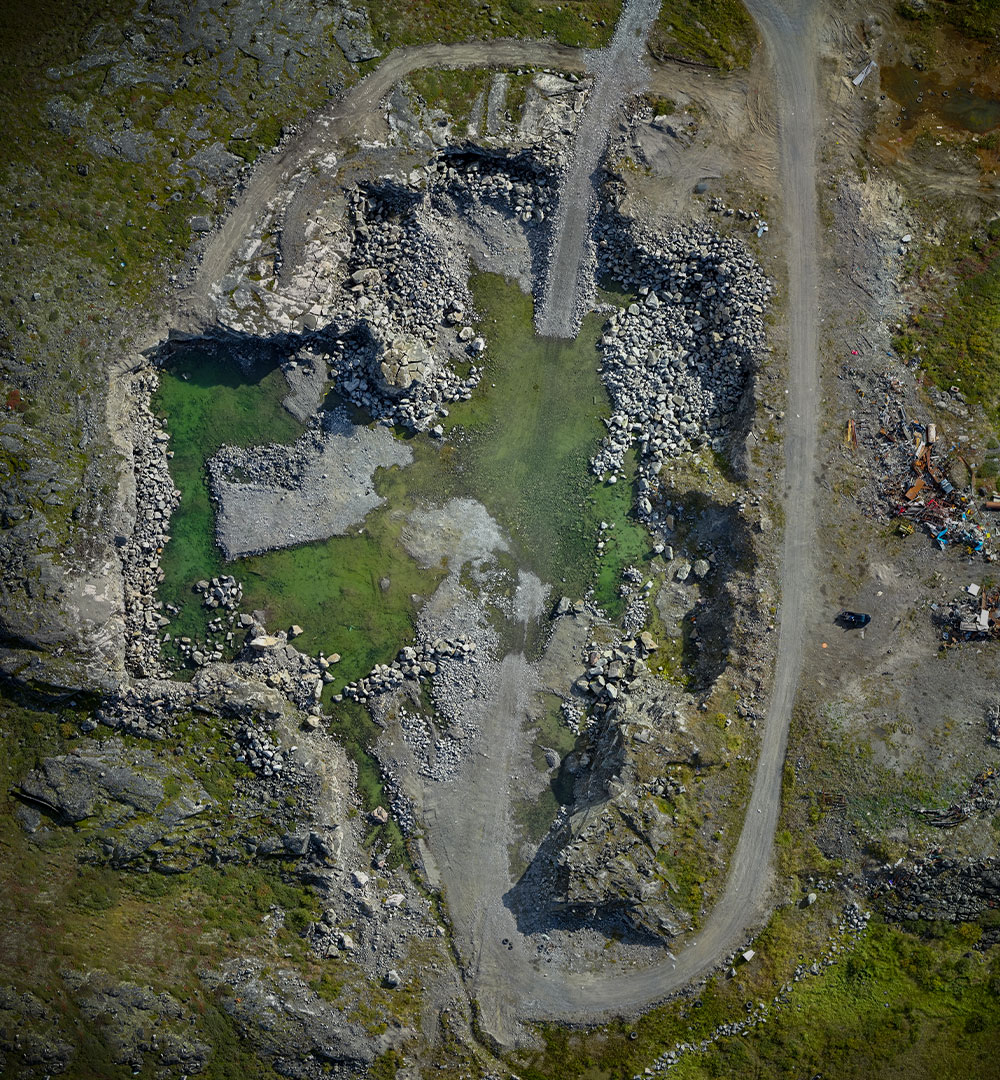
Accurate volume measurement of piles of material is important in a number of applications such as stock-pile inventory management, volumes of tailing piles, volume of organic mat rials in composting operations, quarry pit size, and mine reclamation to name only a few. Piles are difficult to measure due to their size, difficulty of traversing and non-uniform shapes. The advent of drones and post-processing software for extracting surface shapes have greatly assisted in these tasks.
Drones have been used in search and rescue, border patrol, natural disaster response and accident/crime scene reconstruction. A significant benefit of the use of a drone is the quick deployment times and cost effectiveness of repeatable flights in the case of natural disaster response.
The agriculture industry is considered one of the biggest growth industries regarding the use of drones. Images of fields covering hundreds of hectares/acres can he flown in a single flight without the hassle of manned services at a much lower cost, with far greater resolution than satellite imagery (even with cloud cover) and very repeatable. Once the data is collected, several tools are available to develop additional value-added products. Typical examples of some value-added products may include a row-based plant counting tool and a plant height differential allowing farmers to assess practices, soil compaction and disease. The greatest advantage is combining these tools with other layers of data (topography, yield maps) allowing farmers to create management zones to effectively manage their inputs.
ᑭᖏᑦᑐᒥ ᐊᒻᒪᓗ ᖁᒻᒧᐋᑎᑕᐅᓯᒪᔪᒃᑯᑦ ᐊᑦᔨᓕᐅᕆᓃᑦ
NGI-ᑯᑦ ᐃᑲᔪᕐᓯᓯᒪᓕᕐᑐᑦ ᐱᒍᑦᔨᔭᕐᒥᓂᒃ ᐱᓇᓱᐊᕐᓯᒪᔭᕐᒥᓄᑦ ᓄᓇᕐᔪᐊᒥ ᕿᒥᕐᕈᓂᐅᔪᓂᒃ 2009-ᖑᓕᕐᓂᒪᑦ. ᑮᓇᐅᔭᓕᐅᕋᓱᐊᖃᑎᐅᑦᓱᓂ ᐊᖏᓂᕐᐹᓄᑦ ᖁᒻᒧᐊᑎᑕᐅᓯᒪᔪᒃᑯᑦ ᐊᑦᔨᓕᐅᕆᔩᑦ ᑐᓂᐅᕐᙯᓕᕐᓂᒃ ᐱᑐᑦᓯᒪᖃᑎᒌᖏᑦ ᓯᓚᕐᔪᐊᓕᒫᒥ, ᐱᕕᑦᓴᖃᕐᑎᓯᒍᓐᓇᑐᒍᑦ ᐃᓕᓐᓂᒃ ᐊᒥᓱᐹᓗᓐᓂᒃ ᑎᒃᑯᐊᒐᑦᓴᓂᒃ ᑮᓇᐅᔭᓕᐅᕋᓱᐊᕐᓂᒨᓕᖓᔪᓂᒃ ᓄᓇᕐᔪᐊᒥ ᕿᒥᕐᕈᓂᕐᒧᑦ ᖁᒻᒧᐊᑎᑕᐅᓯᒪᔪᖏᓐᓄᑦ.
ᐱᓇᓱᑦᑎᕗᑦ ᐱᒍᓐᓇᐅᑎᓖᑦ ᐱᓪᓗᑯᑦᑐᓕᕆᒍᓐᓇᓱᑎᑦ ᐃᑲᔪᕈᓐᓇᑐᑦ ᑎᒃᑯᐊᓯᑎᓪᓗᑎᑦ ᐊᑦᔨᖑᐊᓂᒃ ᐃᓱᐊᕆᓂᕐᐹᑎᓐᓂᒃ ᐱᓪᓗᑯᑦᑕᐅᖁᔭᑎᓐᓂᒃ ᐱᓇᓱᐊᕐᑕᓃᕕᑦ. ᐱᒍᑦᔨᕕᕗᑦ ᐱᑕᖃᕐᒥᔪᖅ ᐋᕐᕿᓱᐃᒍᓐᓇᓂᕐᒥᒃ ᐊᑦᔨᖑᐊᒥ ᐊᒻᒪᓗ ᐊᑐᐃᓐᓇᐅᑎᑦᓯᓂᕐᒥᓗ ᐊᑦᔨᒌᖕᖏᑐᓂᒃ ᐱᔭᐅᒍᒪᓯᒪᔪᕕᓂᕐᓂᒃ.

ᐱᑦᔪᔨᓯᒪᔭᕗᑦ ᐱᓇᓱᖃᑎᒋᓯᒪᔭᕗᑦ
ᖃᐅᔨᒋᐊᕐᕕᒋᓗᒋᑦ ᓄᓇᕕᒻᒥ ᓄᓇᖕᖑᐊᓕᕆᔩᑦ ᐅᓪᓗᒥ
ᒪᓕᒐᕐᑎᒍᑦ ᒪᓕᑦᑕᐅᒋᐊᓕᒃ
ᓄᓇᕕᒻᒥ ᓄᓇᖕᖑᐊᓕᕆᔩᑦ ᐊᔪᐃᓐᓇᓂᖃᓲᑦ ᓴᐳᑦᔨᓂᕐᒥᒃ ᐊᒻᒪᓗ ᖃᓄᐃᖕᖏᓯᐊᕆᐊᖃᕐᓂᖏᓐᓂᒃ ᐱᓇᓱᑦᑎᖁᑎᖏᑦ, ᓂᐅᕕᕐᓂᐊᑎᖏᑦ, ᐱᖁᑎᖏᑦ, ᐊᒻᒪᓗ ᐊᕙᑎᕗᑦ. ᐱᓇᓱᑦᑎᕗᑦ ᐱᓇᓱᒍᑎᑦᓴᖃᕐᑐᑦ ᓴᓇᕐᕈᑎᓂᒃ ᐊᒻᒪᓗ ᖃᓄᐃᓘᕈᓯᕐᓂᒃ ᓴᐳᑦᔨᓂᕐᒧᑦ ᐊᒻᒪᓗ ᖁᕝᕙᒋᐊᕆᓂᕐᒧᑦ ᐊᑦᑕᓇᕐᑐᒦᑦᑌᓕᓂᕐᒥᒃ ᐊᒻᒪᓗ ᐃᓂᕐᕋᓯᐊᕈᓐᓇᓂᕐᒥᒃ. ᐱᓯᒪᑦᓯᐊᑐᑦ ᐱᒍᓐᓇᕈᑎᓂᒃ ᐊᒻᒪᓗ ᐃᓕᑕᕐᓯᒍᑎᓂᒃ ᐱᓯᒪᔪᓂᒃ ᑲᕙᒪᑐᖃᒃᑯᑦ ᑯᐯᒃᑯᓗ ᒪᓕᒐᓕᕆᓂᕐᒧᑦ ᑎᒥᖁᑎᖏᓐᓂᒃ. ᓄᓇᕕᒻᒥ ᓄᓇᖕᖑᐊᓕᕆᔩᑦ ᐱᓇᓱᖃᑎᖃᑦᓯᐊᒪᕆᓲᑦ ᐃᖏᕐᕋᐅᑎᓕᕆᔨᒻᒪᕆᖏᓐᓂᒃ ᑲᓇᑕᐅᑉ ᐊᐅᓚᑦᓯᓲᖑᔪᓂᒃ UAV ᐱᓇᓱᕝᕕᒪᕆᒻᒥᒃ ᑐᓂᓯᓂᒃᑯᑦ ᐅᑦᑐᕋᕐᓂᒥᒃ ᐱᒋᐅᕐᓭᓂᕐᒥᒃ ᐊᒻᒪᓗ ᓓᓴᓐᓯᑖᕐᑎᓯᓃᑦ ᐱᓇᓱᐊᕐᑕᐅᑎᑦᓯᒍᑎᖏᓐᓂᒃ.

1111 Dr. Frederik-Phillips Blvd.
3rd Floor
Montreal, Quebec
Canada
H4M 2X6

